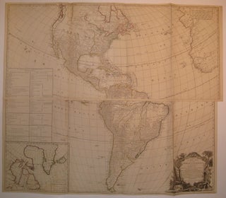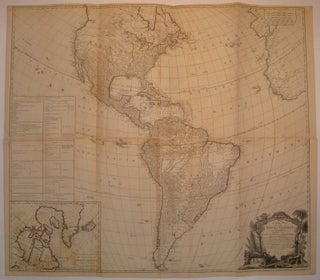
A New Map of the Whole Continent of America, Divided into North and South and West Indies, wherein are exactly the Described the United States of North America as well as the Several European Possessions according to the Preliminaries of Peace signed at Versailles Jan. 20, 1783...
London: Robert Sayer, 1786. Map in four sheets joined into two panels (top and bottom). Engraving with original hand outline color. Each panel measures about 20.25" x 46 5/8". Outstanding wall map of the Americas and West Indies, reflecting the political boundaries decided upon in the Treaty of Versailles or Peace of Paris of 1783 which ended the American Revolutionary War. Fantastically detailed topographical and geographical elements, place names and Native American tribes. Shows "River of the West" with a...... More