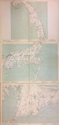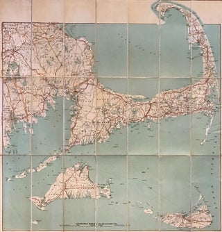
Automobile Map of Massachusetts Cape Cod Section
Boston: Geo. H. Walker & Co., 1906. Map. Colored lithograph. Sheet measures 30.5" x 29.5". This beautiful 1906 pocket map of Cape Cod, Nantucket, and Martha's Vineyard from 1906 was issued by George H. Walker & Co. Specifically designed for the automobile traveler, it identifies state roads, good automobile routes, electric railways and other routes. Covers from Bridge Water to Nantucket Island. Beautifully detailed, it also notes several towns, cities, bays, islands, ferry routes, lighthouses, shoals, banks, and several other..... More