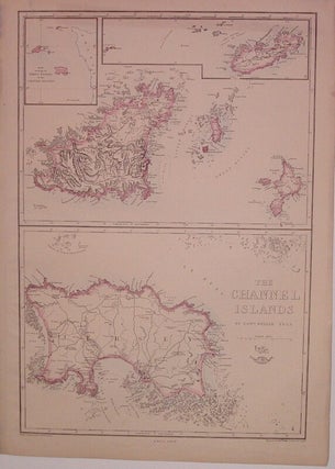
The Channel Islands
London: Edward Weller, 1863. Map. Engraving with original hand outline. Collective images measure 17.25" x 11.75". Map of Guernsey, Herm and Sark with insets of Alderney and "A Map showing the Relative Positions of the Channel Islands", and a separate map of Jersey. Part of a series of county maps for the "Weekly Dispatch Atlas". A few tears to top edge. More