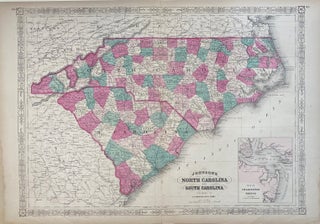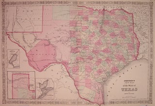
Johnson's New Map of the State of Texas
New York: Johnson & Ward, 1867. Map. Engraving with original hand coloring. Image measures 16.75" x 24.5". Beautifully detailed double page map of Texas divided into counties, with the northern part of the state in an inset. Shows towns, waterways, major routes, railroads and topographical details. Includes uncolored inset maps of Galveston Bay and Sabine Lake. In excellent condition. Also available in 1866 edition. Alvin Jewett Johnson (1827-1884) is one of the most prolific American publishers of the 19th century..... More