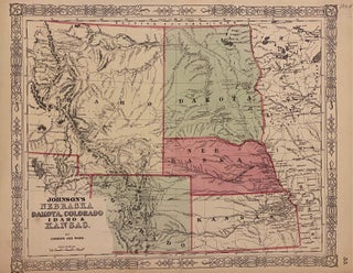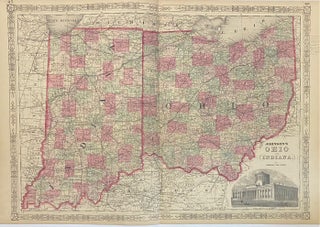
Johnson's Ohio and Indiana
New York: Johnson & Ward, 1864. Map. Engraving with original hand coloring. Image measures 17" x 24". Beautifully detailed double page map of Ohio and Indiana divided into counties and townships. Shows towns, major routes, waterways and railroads. Includes image of the state capitol building in Columbus. In very good condition. Pencil notations in right margin. Alvin Jewett Johnson (1827-1884) is one of the most prolific American publishers of the 19th century. He opened his own company in 1856 that..... More