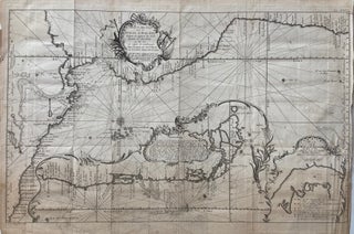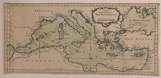
Carte Reduite De La Mer Mediterranee
Paris: 1764. Map. Copper engraving with hand coloring. Measures 9 3/4" x 20". Beautifully engraved map of the Mediterranean Sea, extending from the strait of Gibraltar to the Levant. The coastlines are rendered with meticulous detail, with major cities, ports, capes, and islands labeled. Mountains are depicted pictorially. The map was published in Bellin's "Petit Atlas Maritime," which covered the coasts and important port cities of the known world. This map is in good condition with no chips or tears..... More