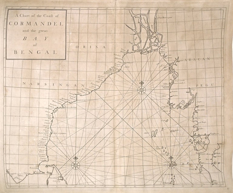
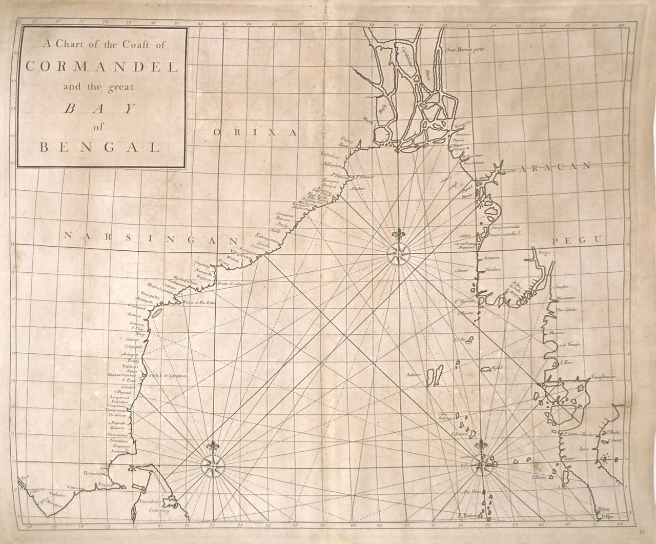
A Chart of the Coast of Cormandel and the Great Bay of Bengal
London: James and John Knapton, 1728.
Sea Chart. Uncolored engraving.19 x 22 1/2 inches.
This beautiful early sea chart of the Coromandel coast in Southeast India covers the entire eastern coast of India as well as the western coast of Burma (Myanmar) and southern Thailand. Extends from modern day Kanyakumari north to include the Ganges River Delta, the coast of Bangladesh and then south along western coast of Burma or Myanmar to Thailand. The northern parts of Sri Lanka or Ceylon are also included. The chart notes several villages and settlements along the coast. Islands, coastal features, rhumb lines and other geographical features are also noted.
The Coromandel Coast was one of the most important regions for the British, Dutch, French, Danish and Portuguese during this time as much of the Indian trade was controlled through its various harbors and ports.
This chart was made by Senex for the 1728 issued of "Atlas maritimus & commercialis, or, A general view of the world, so far as relates to trade and navigation". The atlas which was meant to compete with Mount and Page's popular "English Pilot", was a collaboration between some of the leading cartographers of the time, including Sir Edmund Halley, John Senex, Nathaniel Cutler, Steven Parker and Daniel Defoe. The atlas unfortunately failed to achieve commercial success as great as its rival, making this a hard-to-find map.
The map is in good condition with minor wear along the original centerfold and overall toning. Map is lined with archival paper.
John Senex (1678-1740) was a kind of Renaissance man of the 18th-century map world, working at times as a scholar, surveyor, engraver, astrologer, book seller and publisher of maps, atlases and globes. In a short period, he developed from an apprentice into one of the most important cartographers of the period and became a Fellow of the Royal Society of London, as well as Official Geographer to Queen Anne of Great Britain. Although well regarded for his pocket-size maps, Senex is probably best known for his globes, which display a knowledge of astronomy equal to the skill of their craftsmanship. After his death in 1740 his wife Mary continued his business and continued to produce and sell cartographic works of high quality. Together, their work represents a successful and valuable partnership in 18th-century mapmaking and publishing.
Sir Edmond Halley (1656--1742) was an English astronomer, geophysicist, mathematician, meteorologist, and physicist known for computing the orbit of the eponymous Halley's Comet. He was the second Astronomer Royal in Britain after John Flamsteed. Globular Projection maps were invented by Halley, Harris and Senex. This is a wonderful example of their collaborative work.
Binding: Unbound
Language: English
Price: $650.00
Item #268137