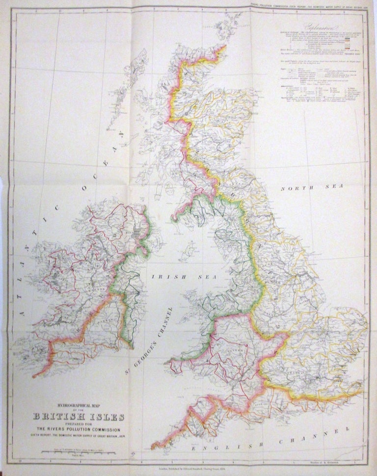
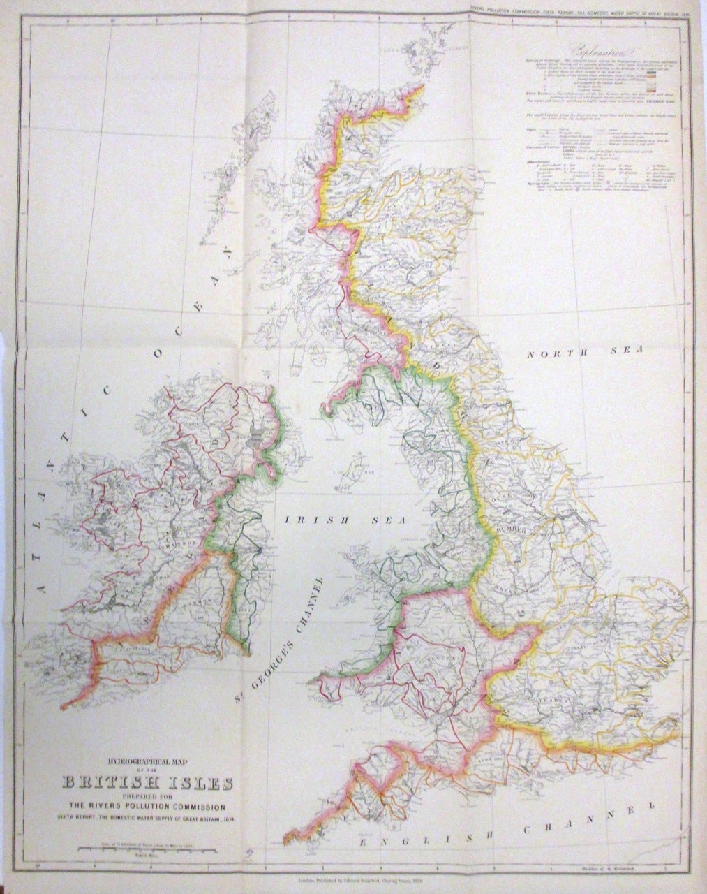
Hydrographical Map of the British Isles prepared for The Rivers Pollution Commission
London: Edward Stanford, 1874.
Map. Colored engraving. Image measures 26.5 x 21".
A lovely hydrographical map of the British Isles depicting England, Wales, Scotland and Ireland in incredible detail. Includes the Orkney Islands. The map shows the hydrography of the region including the system of drainage, rivers, lakes, canals and other important hydrographical features. colored lines indicate the water parting or the natural separation between rivers flowing off in opposites direction according to five great natural division of the United Kingdom. An explanation of the chart in included in the top left of the map. Important cities, ports, bays, towns, and islands are identified.
The map was prepared for The Rivers Pollution Commission. Published by Edward Stanford and issued in the 1874 "Sixth Report of the Commissioners appointed in 1868 to inquire into the best means of preventing the pollution of rivers. The domestic water supply of Great Britain". The report was presented to both houses of Parliament by command of Her Majesty. The map is in very good condition with minor wear along the folds and some foxing.
Binding: Unbound
Language: English
Price: $300.00
Item #266347