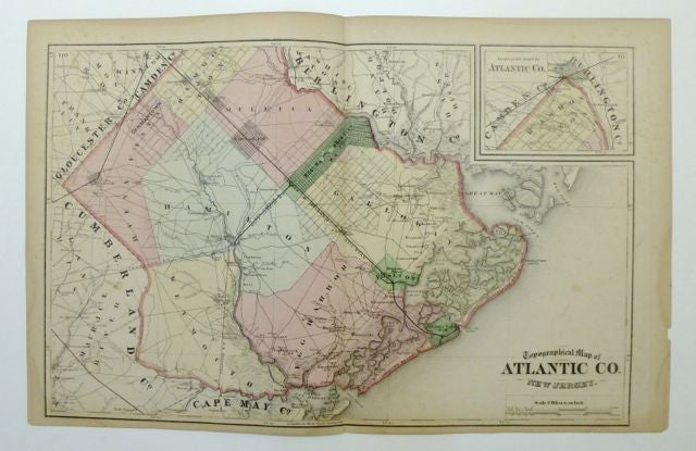
Topographical Map of Atlantic Co. New Jersey
New York: Beers, Comstock & Cline.
Double-page map. Lithograph with original hand coloring. Image measures 12.25 x 22.25".
This map shows Atlantic County in New Jersey, including Atlantic City, Germantown, and Egg Harbor City.
An inset in the upper right shows the northern part of the county that extends past the top margin of the map. Townships are designated by color, and a thick pink border separates the county from its surroundings. Rhumb lines extend out from the coasts of Absecon and Brigantine Beaches into the Atlantic Ocean on the eastern border. The map appeared in Beers's "State Atlas of New Jersey. It is in very good condition with some staining and discoloration in the margins. Frederick W. Beers (1858-1929) continued the work of his father James Botsford Beers and was known for his county survey maps of New York, Ohio, Pennsylvania, Michigan, Connecticut and Vermont
Binding: Unbound
Language: English
Price: $175.00
Item #255440