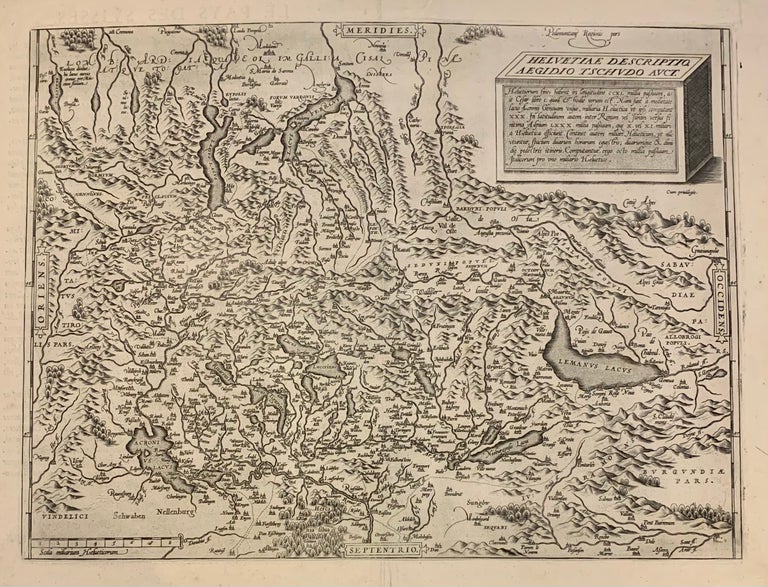
Helvetiae Descriptio. Aegidio Tschvdo Avct.
1598.
Map. Engraving. Image measures 13.5 x 18 inches. Sheet measures 16.5 x 20.5".
This 1598 map of Switzerland is centered on Lake Lucerne and include much of Northern Italy. Oriented with south to the top, the map extends from Lakes Como and Maggiore down north to Lake Constance. This map marked considerable progress in the mapping of Switzerland, including as it does significant cities and locales. Furthermore, a plinth rendered in three dimensions in the upper right corner of the map bears an inscription describing the geography of the region in Swiss miles. Given its wealth of information, the map served as a productive model for Abraham Ortelius's map of Switzerland as published in his 1570 "Theatrum Orbis Terrarum," considered the first modern atlas of the world. The map is in good condition with repair to top center seam margin, some foxing. French text on verso. Aegidius Tschudi (1505-1572) was a prominent member of Swiss society best known for his history of the early Swiss Confederacy, Chronicon Helveticum. While his findings were greatly influenced by the prestige of his family, his work did contribute to a considerable increase in knowledge of the Confederacy as it began in the 14th century and consequently developed.
Language: English
Price: $600.00
Item #251164