
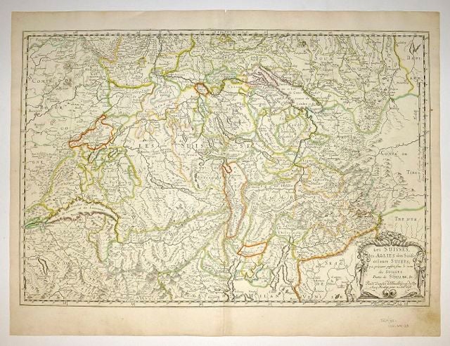
Les Suisses les Allies des Suisses et leurs Suiets; qui peuvent passer Sous le mon de Suisses. Partie de Souabe, &c
Paris: 1648.
Map. Engraving with hand outline color. Image measures 14.5 x 21.5 inches.
This map of Switzerland centers on Lucerne, covering approximately the area from Lake Constance south to Lake Como in Italy. Published in 1648, the map dates to the period of the Old Swiss Confederacy. Furthermore, it predates by only a few years the Swiss Peasant War of 1653, a siege of Lucerne and Bern that demonstrated the significance of the rural population to the confederacy's stability. Hand-colored outlines on the map indicate the various independent states that made up the confederacy. A title cartouche with elaborate scrollwork adorns the lower right corner of the map. The map is in good condition with full margins and no chips or tears. Wear to lower margin.
Nicolas Sanson (1600-1667) is considered the founder of the French school of cartography. In reaction to the prevailing trend of Dutch lavishness, Sanson favored minimal details, focusing rather on accurate cartography than ornament. This map demonstrates the skill that made him such a valuable asset to the French monarchy.
Binding: Unbound
Language: English
Price: $375.00
Item #251162