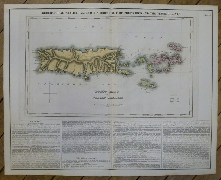
Geographical, Statistical, and Historical Map of Porto Rico and the Virgin Islands.
Philadelphia: Carey & Lea, 1822.
Map. Engraving with original hand coloring. Image measures 15"x 14.5", image plus text measures 16.5" x 20.5".
Beautiful map of Puerto Rico and the Virgin Islands on a large scale. An explanation of colonial activity is provided as well as the publisher's signature text surround pertaining to history, climate and culture. The map was printed in Carey & Lea's "Complete Historical, Chronological, and Geographical American Atlas". Very good condition with no chips or tears or foxing. The Philadelphia-based firm of Carey & Lea of Philadelphia was one of the most important publishers in the early 19th-century United States. Run by Mathew Carey (1760-1839) and Isaac Lea (1792-1886), the company worked with both books and maps, specializing particularly in political commentary.
Illustrator: J. Finlayson
Binding: Unbound
Language: English
Price: $750.00
Item #249021