![Item #242940 Mappa A. [Western Hemisphere.]. Girolamo TASSO.](https://argosybooks.cdn.bibliopolis.com/pictures/242940.jpg?width=768&height=1000&fit=bounds&auto=webp&v=1371064883)
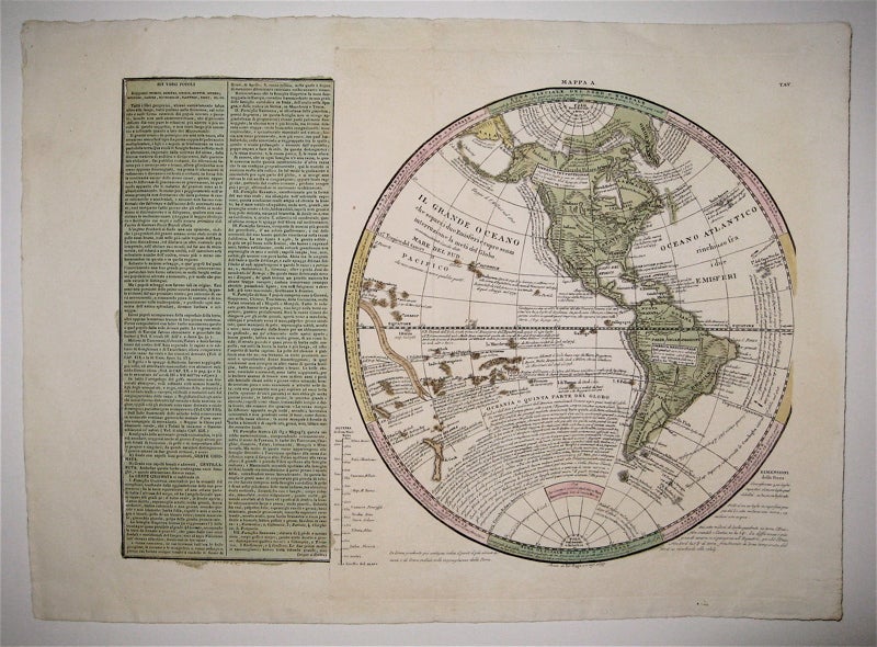
Mappa A. [Western Hemisphere.]
1835.
Map. Engraving with original hand coloring. Image measures 13.5" x 18.5".
This creative map of the western hemisphere is both attractive and informative, featuring a map offset to the right by a descriptive text about the populations of the region to its left. Tasso has weaved a wealth of descriptive text in Italian into his elegant renderings of North and South America, using words to draw out the unique coastlines and island formations of the region. The vast Pacific Ocean has been almost entirely filled with text on topics as wide as geography, history, and exploration under the heading of "Oceania or the Fifth Part of the Globe." Nearby islands are labeled with the date of their discovery and, when possible, the name of their discoverer. Elsewhere, soaring text describes the paths of famous voyages. Around the outside of the map, temperature zones are indicated with geographical and climatological description. In the lower left is an account of the earth's dimensions, and in the lower right, between the map and the text block, is an account of worldwide elevations.
The map is from the 1835 edition of Le Sage's "Atlante Storico, Geografico, Genealogico, Cronologico, e Letterario." It is in excellent condition with beautiful hand coloring and crisp lettering. Wide margins as issued. Emmanuel-Augustin-Dieudonné-Joseph, comte de Las Cases (1766--1842) was a French atlas-maker (aka Le-Sage) and author.
Language: English
Price: $350.00
Item #242940