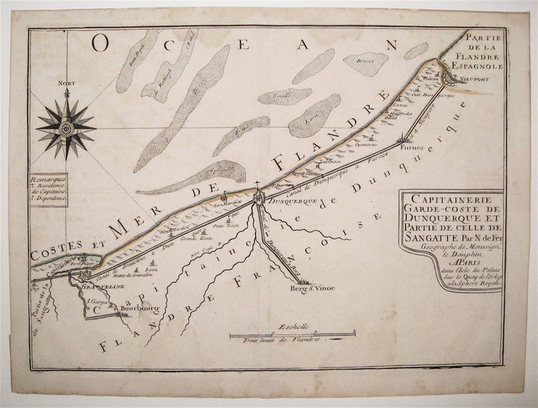
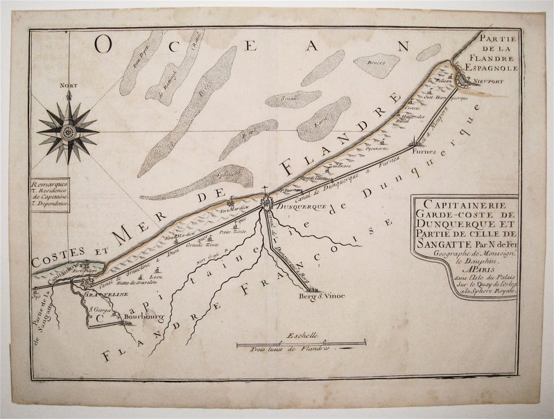
Capitainerie garde-coste de Dunquerque et partie de celle de Sangatte
Map. Engraving with original hand coloring. Image measures 8.75" x 12".
This charming map of Dunkirk shows the city as it sits on the coast of the southernmost part of the North Sea, here labeled as the Sea of Flanders. Working circa 1705, De Fer has represented the city with a schematized drawing of its exterior walls. Canals connecting the city to nearby towns and churches are also depicted and labeled. Sand bars are drawn and mountains are represented pictorically, and a decorative compass rose at the upper left points due north. The map is in very good condition with no chips or tears and minor staining. Nicolas de Fer (1646-1720) was a French cartographer, engraver and publisher. He became official geographer to the French Dauphin (1691) and to the Spanish King (1702) and was renowned particularly for his maps of the French coast, of which this is a fine example.
Language: English
Price: $65.00
Item #239457