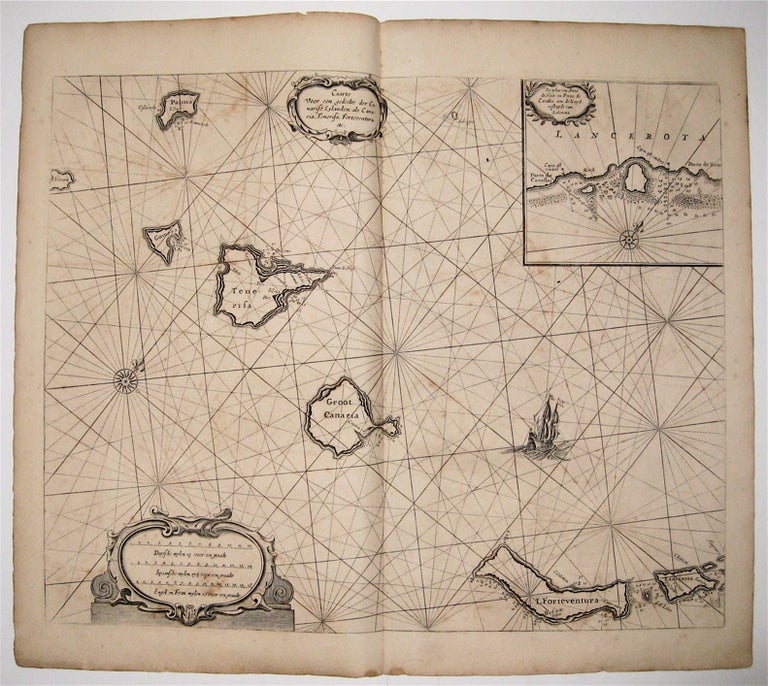
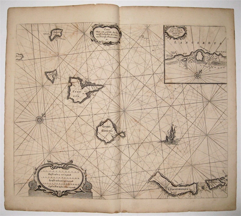
Caarte voor een gedeelte der Canarise Eylanden
Amsterdam: Jacques & Gasper Anthoine, 1669.
Sea chart. Uncolored copperplate engraving. Image measures 17 1/4" x 21 1/4".
This rare sea chart by Pieter Goos shows the Spanish territory of the Canary Islands off the coast of northwest Africa. It encompasses, from left to right, El Hierro, La Palma, La Gomera, Tenerife, Gran Canaria, Fuerteventura, Isla de Lobos, Lanzarote, La Graciosa, Montaña Clara, and Alegranza. In addition to ports, the map includes soundings, sand bars, fishing banks and navigational hazards. It also features rhumb lines, scales, a ship, and an embellished compass rose, as well as a decorative title cartouche with scrollwork. An inset map shows the harbor of Lanzerote, an important 17th-century Dutch trading center, with another small cartouche and compass rose. This map was published in Goos' "De Zee-Atlas Ofte Water-Weereld" and remains in its original uncolored state, which allows Goos' intricate line work to shine. It is in good condition with slight foxing, soiling, and off-setting. Only small chips to edges, not affecting the image. Pieter Goos (1616-75) was a Dutch cartographer, engraver, publisher, printer, and print-seller based in Amsterdam. He belonged to a noted family of cartographers, headed by his father Abraham, who prepared plates for many maps published in the important atlases of the time. His pilot guide, the "Zee-Spiegel," provided some of the first charts of newly explored regions in the West Indies and Western Africa, and his "Zee-Atlas" is considered one of the best sea atlases of its time. This map is a fine example of Goos' high quality, visually appealing sea charts.
Binding: Unbound
Language: English
Price: $1,350.00
Item #235511