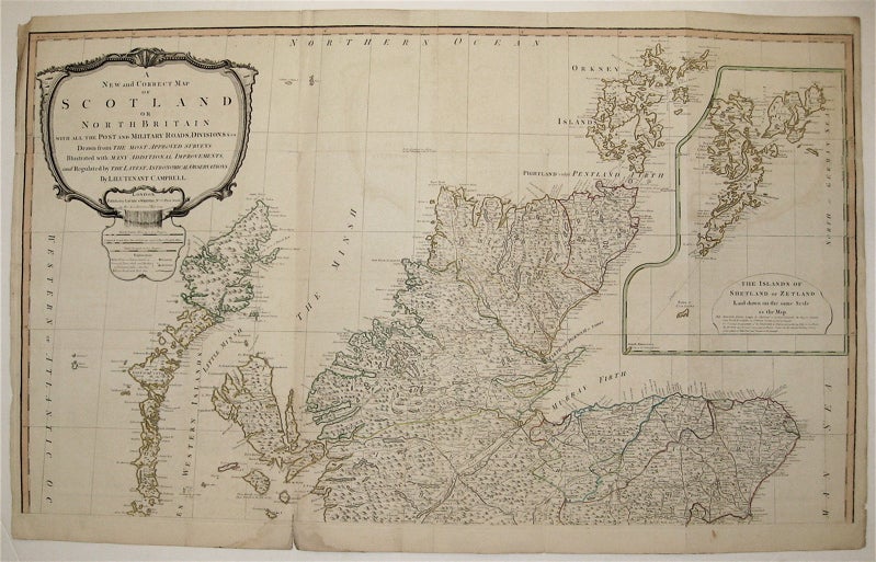
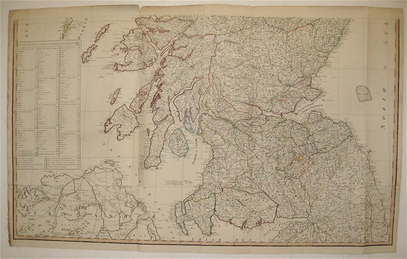
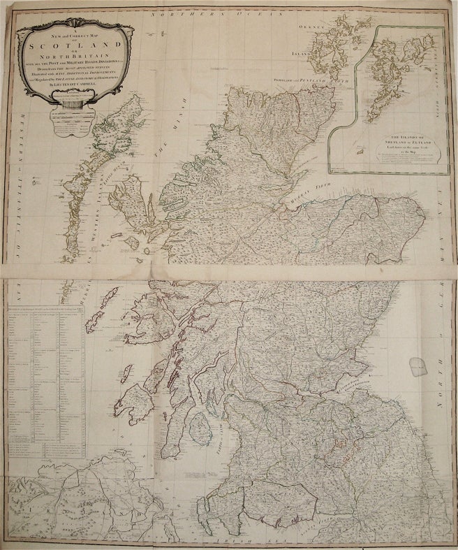
A New and Correct Map of Scotland or North Britain with all the Post and Military Roads, Divisions, &c
London: Sayer, 1794.
Map, in two sheets. Copper plate engraving with original outline hand color. Each image measures 24.25" x 21.25".
This large-scale wall map of Scotland depicts the country in intricate detail. Based on the work of Marcus Armstrong, this two-part map has a particular focus on military and post roads. Hand-colored lines divide and subdivide shires, mountains are depicted pictorially, and bodies of water such as lochs and firths are all labeled. At the upper right is a large inset of the "The Islands of Shetland or Zetland." The upper left corner contains a decorative title cartouche, and the map's lower left contains a key of "Distances of the Principal Stages on the Great Roads Leading from Edinburgh." The map is in good condition with some chips and stains in the margins . Minor offsetting throughout. Robert Laurie (c. 1755 - 1836) and James Whittle (1757-1818) were London-based map and atlas publishers active in the late 18th and early 19th century. Their firm combined Laurie's engraving skills with Whittle's social contacts and print sales experience. Together, they published numerous maps and atlases, often enlisting prominent cartographers such as Kitchin, Faden, Jefferys and others to update and modify their plates. This large map is an impressive example of their work.
Binding: Unbound
Language: English
Price: $1,100.00
Item #234501