
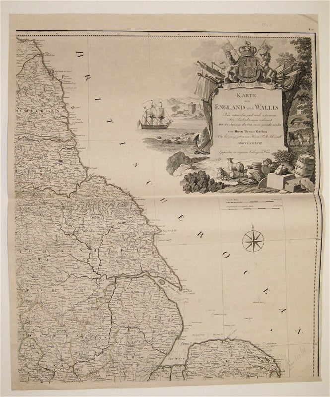
Karte von England and Wallis
Vienna: F.A. Schraembl, 1787.
Map, on 4 sheets. Copper plate engraving with subtle outline hand coloring. Each panel measures 25" x 21 1/4".
This detailed, 4-part map depicts England and Wales. Towns, roads, political boundaries, and topography, including fields and mountain ranges, are all labeled in German in accordance with a textual key. A stunning cartouche in the upper right corner depicts a rocky shoreline adorned with a monument, engraved with the map's title and topped by Britain's Royal Coat of Arms. Symbols of the British Empire, particularly its trade and military, surround the monument. The map is a revised version of Kitchin's 1777 map--his largest and most detailed of the region--and appeared in the 1788 edition of Schaembl's "Allgemeiner Grosser Atlas." The map is in good condition with scattered pencil markings and very slight foxing. Franz Anton Schraembl (1751-1803) was a Vienna-based cartographer whose aspired with his "Allgemeiner Grosser Atlas" to provide highly up-to-date maps of the world. Schrambel derived his maps from the work of contemporary cartographers like D'Anville and Kitchin, as well as explorers such as Cook, Roberts, and others. This map is a fine testament to the power of the British Empire in the late 18th century.
Binding: Unbound
Language: English
Price: $400.00
Item #234098