
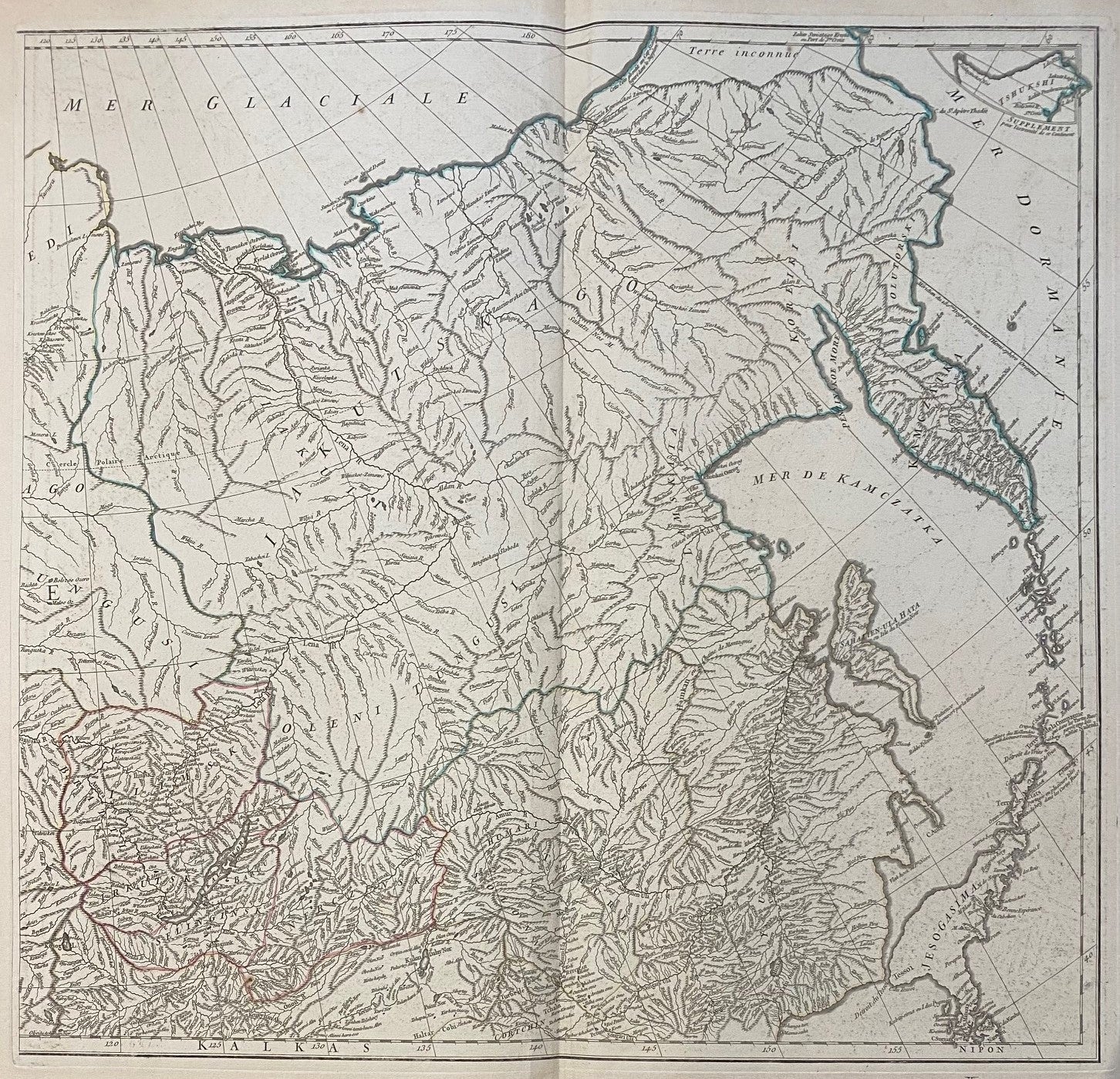
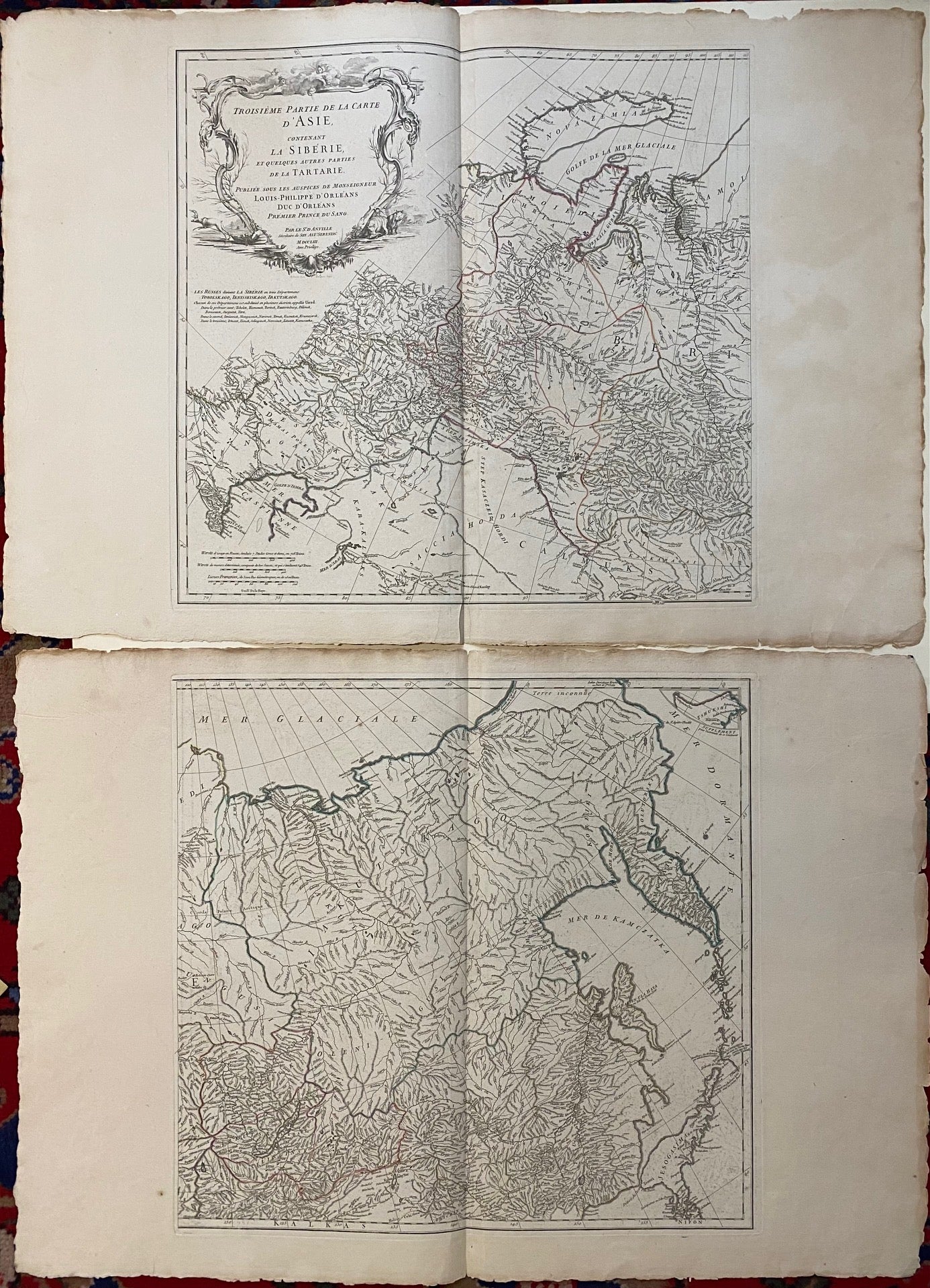
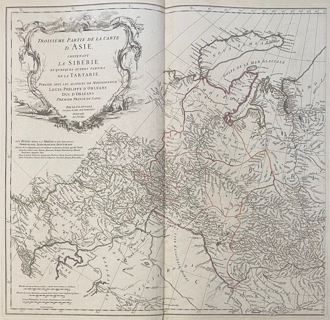
Troisième partie de la carte d'Asie, contenant la Sibérie, et quelques autres parties de la Tartarie
Paris: Jean Baptiste Delafosse, 1753.
Map. Engraving with hand-coloring. Images measure 10 1/4 x 21". Sheets measure 23 x 33 1/2".
This diptych map of Tartary illustrates the countries, rivers, and topography of the region. The map extends from Afghanistan to Kamczatka and from the Arctic Circle to Mongolia. Country borders are hand-colored. A decorative cartouche with Siberian wildlife and personifications of the trade winds appears in the upper left-hand corner with geographical notes in French below. The map is in good condition with full deluxe margins. Both sheets have some chips and staining at the edges, not affecting the image. Jean Baptiste Bourguignon d' Anville (1697-1782) was a French geographer and cartographer whose accurate, research-based work raised the standards for 18th-century map-making.
Language: English
Price: $650.00
Item #233747