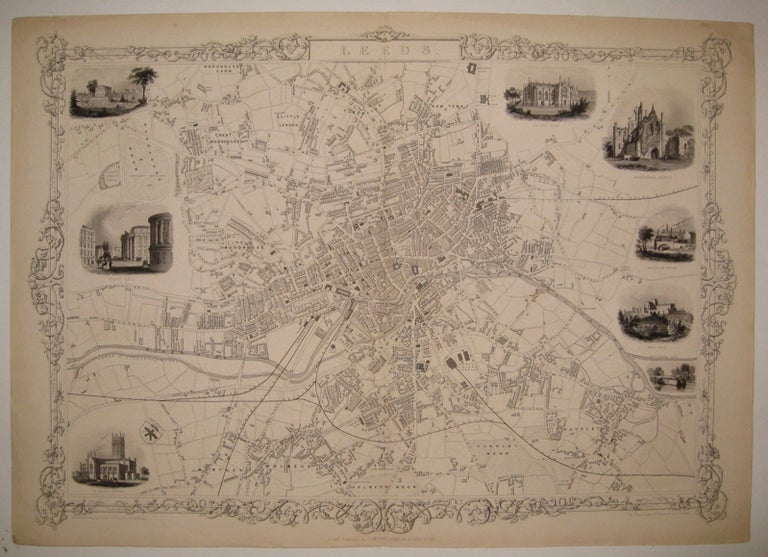
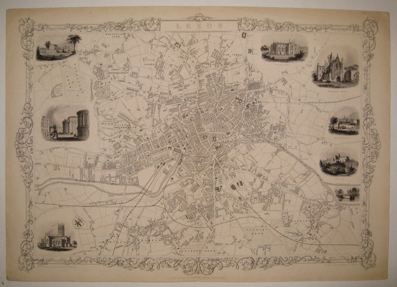
Leeds
London: Tallis, John, 1851.
Map. Steel engraving. Image measures 14.25" x 19.75".
Classic town plan of Leeds in North East England on the Aire River in West Yorkshire. Includes districts, Railroads, cricket fields, moors and canals. The plan is surrounded eight lovely vignettes of notable buildings. No stains or chips or cropping usually seen in the Tallis series, in excellent condition. John Tallis Jr. (1817-1876) was a London born bookseller who continued the prolific map publishing company started by his father. After a partnership with his brother, Tallis Jr. expanded the business to New York in 1849 as well as Boston, Cincinnati, Rochester, Philadelphia and Baltimore. This well known series of eighty maps was published in "Tallis's illustrated atlas and modern history of the world". This map is from the rare supplementary town plan series.
Illustrator: Rapkin, J.
Binding: Unbound
Language: English
Price: $350.00
Item #228340