
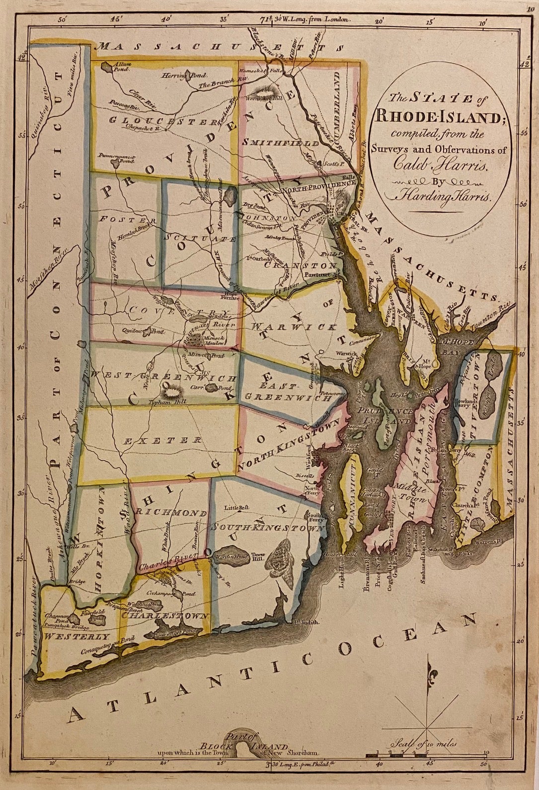
The State of Rhode Island; compiled from the Surveys and Observations of Caleb Harris by Harding Harris
Philadelphia: 1814.
Map. Engraving with hand outline color. Image measures 13 5/8" x 9 3/8".
Charming and early map of Rhode Island divided into counties. Shows towns, major routes, waterways and geographical and topographical features. Includes the northern tip of Block Island. Published in Carey's "General Atlas". Light scattered staining.
Mathew Carey (1760-1839) was an Irish-born American publisher, bookseller, and economist, as well as one the most important figures of early American cartography. Carey was based in Philadelphia, where he apprenticed for Benjamin Franklin before establishing his own book shop and publishing firm. He is credited with publishing the first American atlases, producing some of the best quality maps and most informative depictions of the United States in the early period after it gained independence.
Binding: Unbound
Condition: Very Good
Language: English
Price: $400.00
Item #225544