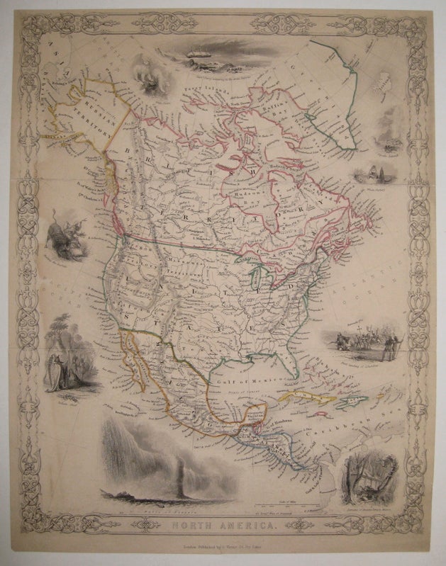
North America
London: G. Virtue.
Map. Engraving with original hand outline. Image measures 12.5" x 9.75".
Rare map of North America, circa 1855. After Tallis, this detailed map shows Greenland, Canada, Alaska (Russian territory), the United States, Mexico and Central America. The vignettes are characteristic of Tallis, but different subject matter from his own "North America" map: "Geysers, Iceland", "Whale Fishery", "First landing of Columbus", "Remains of Ancient Temple, Mexico", "Falls of Niagara", "Indian Chief", "Hunting the Buffalo", "White Bears" and "Captn. Perry wintering in the Arctic Regions". Individual states and provinces are not named, save for a few territories and regions (Oregon and Missouri Territory, California and Florida). Shows cities, waterways, mountain ranges and railroads. Minor wear to original horizontal folds, overall toning, a few scattered tears.
Binding: Unbound
Condition: Very Good
Language: English
Price: $300.00
Item #223165