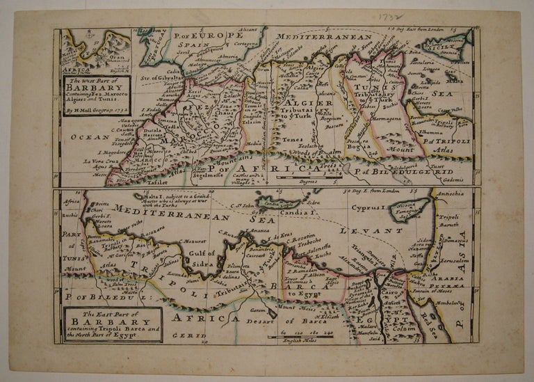
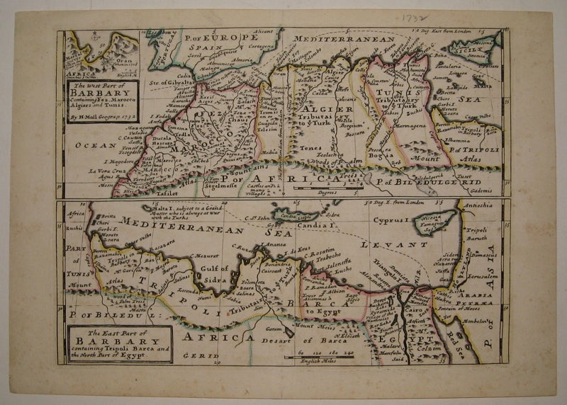
The West Part of Barbary Containing Fez, Marocco Algiers and Tunis and The East Part of Barbary containing Tripoli Barca and the North Part of Egypt.
London: 1732.
Map. Copper plate engraving with original hand outline. Image measures 7 15/16" x 10.75".
Fine antique map in two sections showing the northern coast of Africa from Morocco and the Strait of Gibraltar to Cyprus and the Red Sea. In addition to political boundaries and geographical features, Moll includes a few cultural and historical descriptions. Of Malta he writes "subject to a Grand Master who is always at war with the Turks", and he notes the pyramids and locations of castles and villages. A small inset at top left shows the Port of Oran.Herman Moll (c. 1654-1732) settled in London in the 1670's where he worked as an engraver for Moses Pitt. By the turn of the century, Moll became the foremost map publisher in England, where he produced Atlases and maps. As an engraver, cartographer, mapseller and globemaker he appealed to the public with his unusual views and vignettes. As the demand for his work was sustained, he issued many revised editions of his work.
Binding: Unbound
Condition: Very Good
Language: English
Price: $300.00
Item #220838