

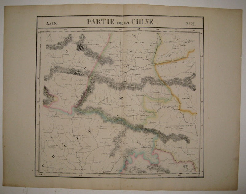
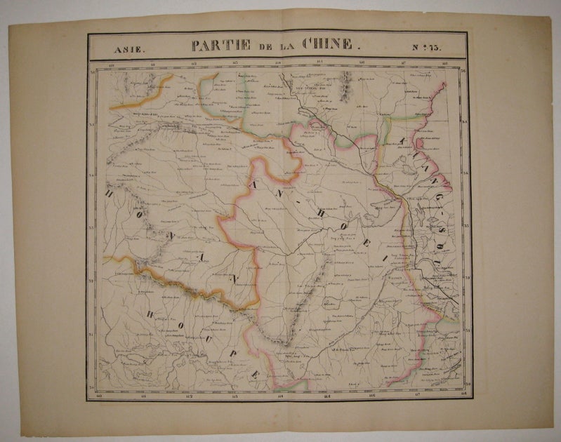
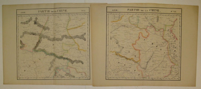
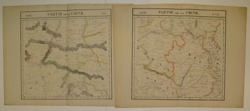
Partie de la Chine. Asie. No. 72 and No. 73.
Brussels: Vandermaelen, Phillipe Marie, 1827.
Map (diptych). Large format lithograph with original hand outline color. Each image measures 18 3/8" x 19 1/8".
Beautifully detailed set of two maps of eastern central China including part of Hubei, Henan, Anhui, Jiangsu, Shanxi, Shandong, Gansu, Sichuan and Shaanxi provinces. Mountains are delicately treated with hachure marks and major rivers and waterways are also shown. Minor overall toning and a few tears to edges. From Vandermaelen's 6 volume "Atlas universel de geographie physique, politique, statistique et mineralogique, sur l'echelle de 1/16411836". Can be combined as gores to form an immense globe. The atlas was the first to map the world on a uniform scale.
Binding: Unbound
Condition: Very Good
Language: English
Price: $450.00
Item #220293