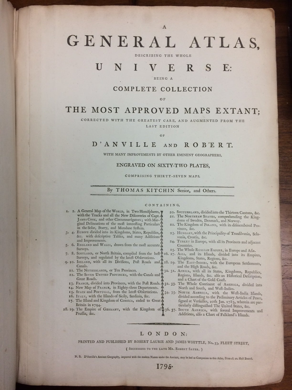
A General Atlas, Describing the Whole Universe; Being a Complete Collection of the Most Approved Maps Extant.
London: Laurie & James Whittle, 1795.
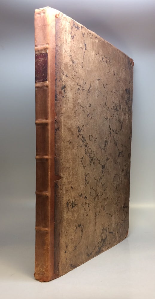
25 maps on 37 double page map sheets with original outline coloring and magnificent cartouches. 12 of the maps are large format diptychs including a beautiful map of the world. Later issue of an atlas first published in 1773 by Robert Sayer. There are no stains or tears. There are manuscript notes in red pencil on the top of plate 22, the map of Poland. Volume measures 54 x 40 cm ( 21 1/2" x 16"). Elephant folio, early calf backed marbled boards, burgundy spine label. London: Laurie & James Whittle, 1795. Very Good (+).
A beautiful clean copy. This edition includes the map of Europe with 72 period naval flags run along the bottom of southern sheet, with a very early depiction of the American flag, with stripes and thirteen stars, at the far right. Thomas Kitchin (1719-1784) was an English engraver and map-maker. His maps and atlases of England earned him the position of hydrographer to the King.
Binding: Hardcover
Condition: Very Good(+)
Language: English
Price: $28,000.00
Item #220117