
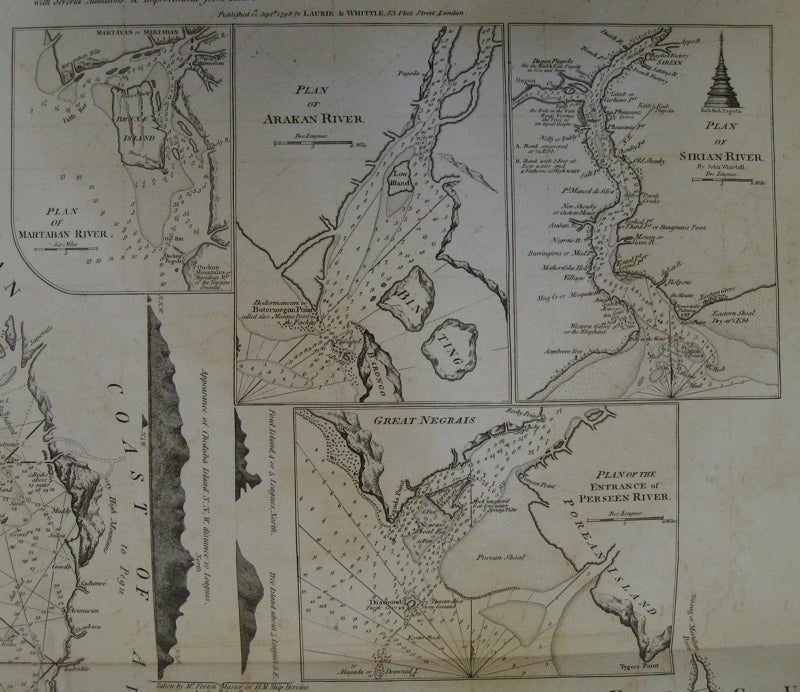


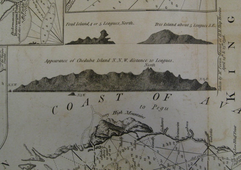
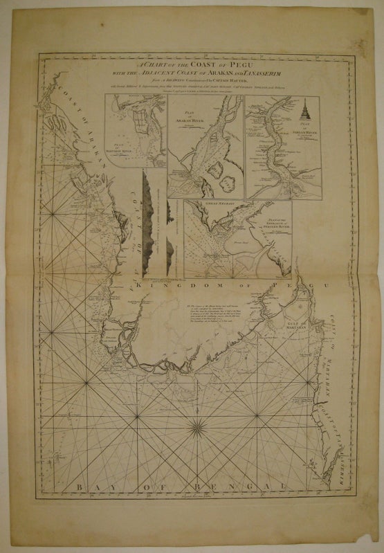
A Chart of the Coast of Pegu with the Adjacent Coast of Arakan and Tanasserim
London: Laurie & Whittle, 1799.
Sea chart. Uncolored copper plate engraving. Image measures 30 5/8" x 22".
Magnificent and intricate sea chart showing the coast of the Burman Peninsula from the Bay of Bengal to the Gulf of Martaban. Details include rhumb lines, depths, and a compass rose. Dotted lines indicate rivers whose paths are not definitively known. Four insets show close ups of the Martaban River, the Arakan River, the Sirian River and the entrance of the Perseen River. Three topographical cross-sections show Foul Island, Tree Island and Cheduba Island. Additional views include three dimensional depictions of some coast lines and a pagoda. Published in "The East-India Pilot, or Oriental Navigator, on One Hundred and Eighteen Plates: Containing a Complete Collection of Charts and Plans, &c..." (plate 78). Maps are based on the 1745 French "Neptune Oriental" by Jean Baptiste Nicolas Denis d'Apres de Mannevillette. The later English editions include additions by Captain Hayter, Captain John Ritchie and Captain Charles Newland. With its beautiful and unusual visual approach, this incredibly scarce sea chart is rarely available for sale. Minor overall toning and offsetting and transference. Chip to bottom right corner of margin, image not affected. Full original margins.
Binding: Unbound
Condition: Very Good
Language: English
Price: $1,550.00
Item #219849