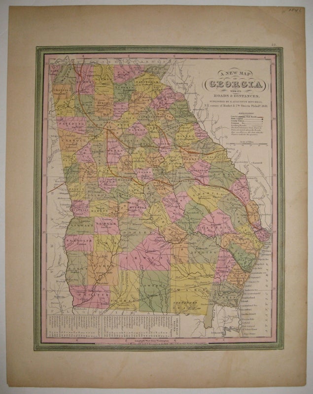
A New Map of Georgia with its Roads & Distances
Philadelphia: S. Augustus Mitchell, 1846.
Map. Lithograph with original hand coloring. Image measures 13 7/8" x 11 3/8".
Great map of Georgia showing all counties, railroads, major routes and waterways. A table at the bottom of the page lists steam boat routes. Minor overall toning, one small tear to bottom edge and a crease to upper left corner.
Samuel Augustus Mitchell Sr. (1792-1868) was one of the leaders in American cartography of the 19th century and pioneered the conversion of engraved map plates to more affordable lithographic plates. His son, Samuel Augustus Mitchell Jr. continued his father's successful mapmaking and publishing business, and was one of the most prolific and renowned 19th century American publishers.
Binding: Unbound
Condition: Very Good(+)
Language: English
Price: $300.00
Item #219154