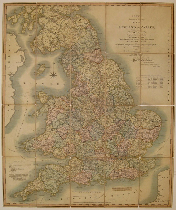
Cary's Reduction of his Larger Map of England and Wales with Part of Scotland; Containing the whole of the Turnpike Roads, the Principal Rivers & the course of the idfferent Navigable Canals...
London: John Cary, 1818.
Case map. Engraving mounted on linen, with original hand coloring. Image measures 29.75" x 24.75".
Beautifully detailed case map of England, Wales and part of Scotland. Shows sailing paths and distances and major land routes, distinguishing between mail coach roads and stage coach roads. Minor overall wear, particularly to linen along original folds. A small stain near compass rose. Original case is intact, but worn. John Cary (1754-1835) was a British cartographer and engraver. His highly detailed and accurate maps mark a turning point from the earlier emphasis on decoration toward a greater emphasis on information.
Binding: Hardcover
Condition: Very Good
Language: English
Price: $750.00
Item #218308