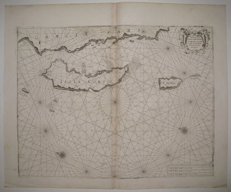
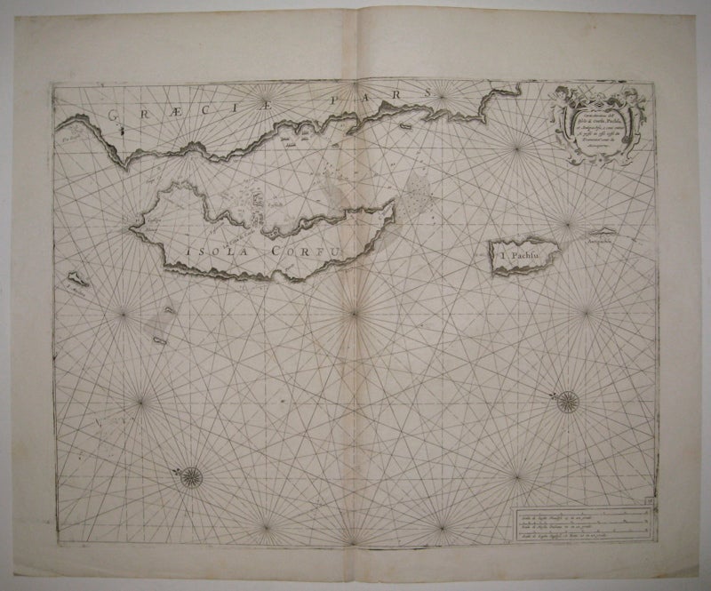
Carta Maritima dell' Isole di Corfu, Pachsu, et Antipachsu, e come entrar si possi in esse cossi da Tramontana come da Mezzogiorno.
Genoa: Francesco Maria Levanto, 1664.
Sea chart. Uncolored engraving. Image measures 15.75" x 20.5".
This incredible 1664 map of Corfu, the second largest Greek Island in the Ionian Sea, was issued by Captain Francesco Maria Levanto. The maritime map or sea chart includes the islands of Corfu, Paxi and the western coast of Greece with north oriented towards the left. Numerous rhumb lines, coastal features, depth soundings, anchorages, shoals, and banks surrounding the islands are noted and serve as a useful guide to the mariner.
The island of Corfu was known to be the bulwark of the European States against the Ottomans and was one of the most fortified places in Europe. The Old Venetian Fortress of Corfu (la Citta di Corfu), identified here, successfully repulsed the major Ottoman sieges of 1537, 1571 and 1716.
This map appeared in Levanto's "Prima parte dello specchio del mare..." (Mirror of the Sea). The atlas was largely based on the work of Anthonie Jacobz and later Pieter Goos (who bought the plates from Jacobz in 1650). Levanto's atlas is the Italian translation and was one of the earliest Italian nautical atlases. The map is in good condition with minor aging along edges. Paper is clean and bright. Increasingly rare Italian map and a fine example of Levanto's work.
Binding: Unbound
Condition: Very Good(+)
Language: English
Price: $3,000.00
Item #217871