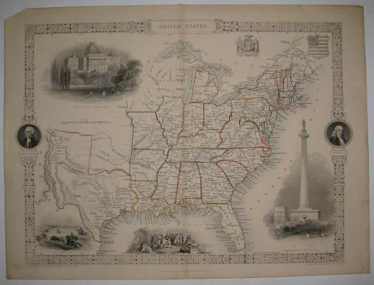
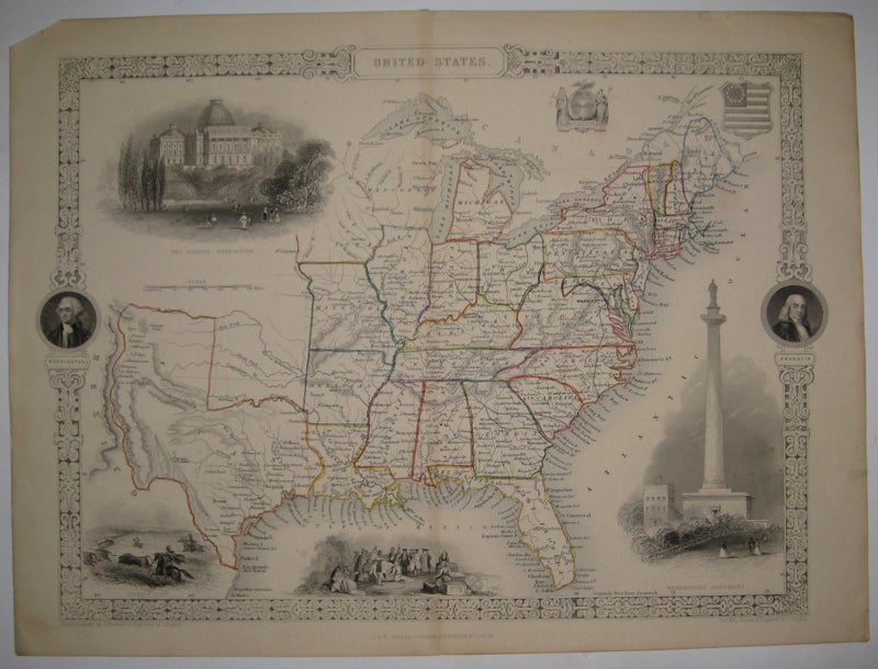
United States
London: Tallis, J & F, 1851.
Map. Steel engraving. Image measures 9.75" x 13.5".
Rare early edition of Tallis' classic United States map. Map extends from the East Coast to Missouri, Iowa and Arkansas. Minnesota is not marked (it became a territory in 1849) and the border of Texas runs along the Rio Grande to the west, encompassing parts of what is today New Mexico, and along the Arkansas River to the north. Vignettes include images of George Washington, Benjamin Franklin, a buffalo hunt, Penn's treaty with the Indians, and the Washington Monument, plus the capitol building in Washington. Light toning along centerfold and edges, chip to upper left corner.
Binding: Unbound
Condition: Very Good
Language: English
Price: $450.00
Item #215502