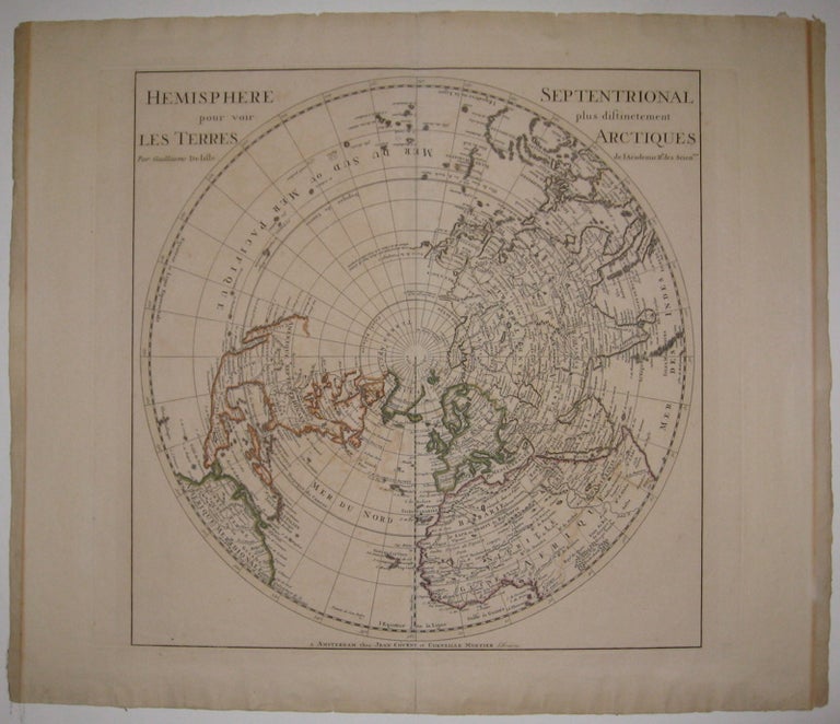
Hemisphere Septentrional pour voir plus distinctement Les Terres Arctiques
Amsterdam: J. Covens et C. Mortier.
Map. Engraving with original hand outline. Image measures 18 1/8" x 17 7/8".
Beautifully detailed map of the Northern Hemisphere, circa 1730. One of the most accurate depictions of the world at the time, Delisle correctly depicts California as a peninsula, though much of Eastern Asia, Russia and North America is yet unexplored. Toning and creasing to left and right edges. A few small tears to edges. Full original margins.
Guillaume Delisle (1675-1726) was a legendary French cartographer known for introducing a new standard of accuracy into 17th-century mapmaking. He was one of the cartographers who propelled the French school of map-making away from Dutch dominance. The French school emphasized science and accuracy over ornament. He used astronomical observations to determine locations and draw more precise coastlines and he continued to update his maps in order to dispel prevailing geographical inaccuracies throughout his life. His wife Marie Angelique Delisle and her family took over the business and kept publishing maps well into the late 18th century.
Binding: Unbound
Condition: Very Good
Language: English
Price: $1,500.00
Item #214379