
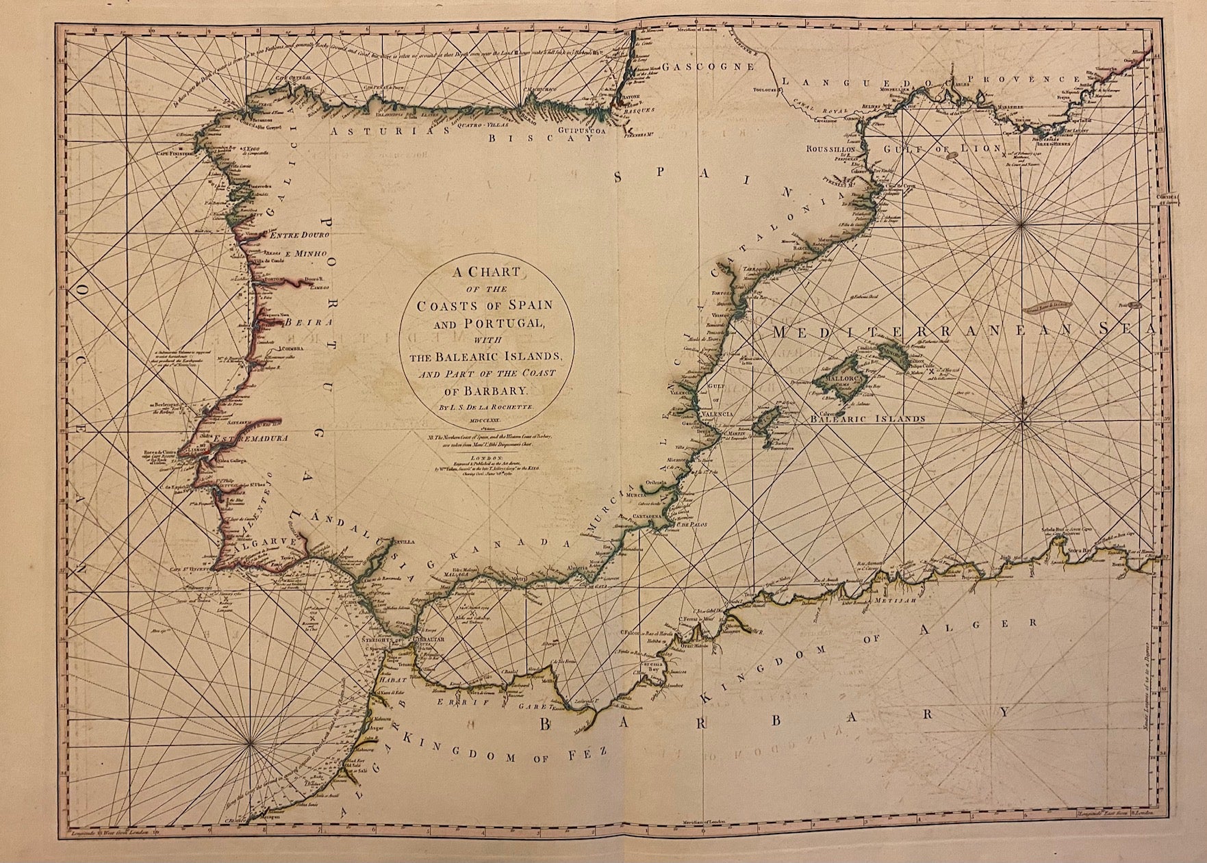
A Chart of the Coasts of Spain and Portugal, with the Balearic Islands, and Part of the Coast of Barbary.
London: William Faden, 1780.
Sea chart. Engraving with original hand outline. Image measures 20" x 27.5".
Beautiful detailed map of the coast of Iberia and northern Africa, with rhumb lines and depths. Coastal features, cities, and rivers are extensively labeled. Regions and kingdoms are noted along the coasts, and minimal inland detail is included. In very good condition, with minor offsetting.
Louis Stanislas d'Arcy De la Rochette (1731 - 1802) was a British cartographer and engraver based in late 18th century London.
William Faden (1750-1836) was an 18th century English cartographer, engraver mapseller and publisher and 'Geographer to His Majesty & to his H.R.H. the Prince of Wales, George III & George IV.
Binding: Unbound
Condition: Very Good
Language: English
Price: $500.00
Item #206837