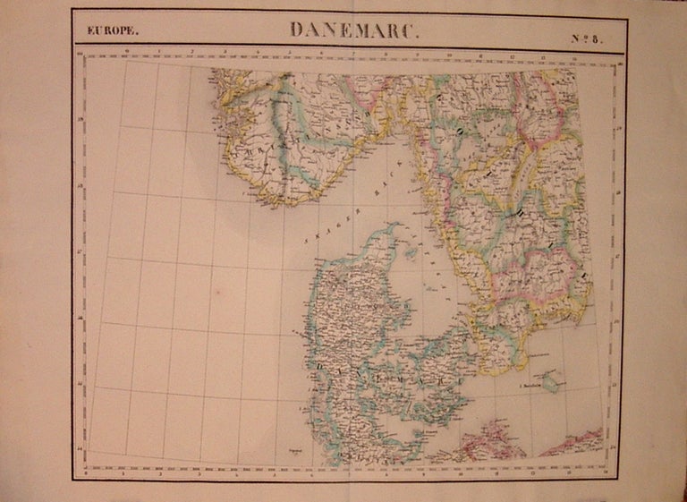
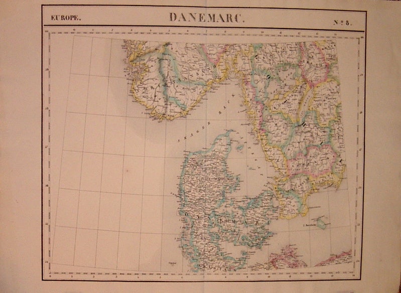
Danemarc. Europe. No. 8.
Brussels: Vandermaelen, Phillipe Marie, 1827.
Map. Lithograph with original hand outline. Image measures 19" x 22.5".
Map of Denmark with rail lines. Map includes both Schleswig and Holstein, while today part of the former and all of the latter are northern Germany. Also shows portion of Sweden and Norway. Double page with centerfold. From Vandermaelen's 6 volume "Atlas universel de geographie physique, politique, statistique et mineralogique, sur l'echelle de 1/16411836". Can be combined as gores to form an immense globe. The atlas was the first to map the world on a uniform scale.
Binding: Unbound
Condition: Very Good
Language: English
Price: $250.00
Item #205010
See all items by Phillippe Marie VANDERMAELEN