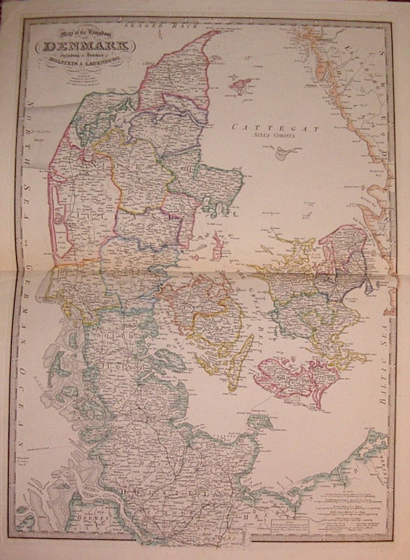
Map of the Kingdom of Denmark including the Dutchies of Holstein & Lauenburg.
London: James Wyld, 1842.
Map. Engraving with original hand coloring. Image measures 28.25" x 20.25".
Shows Denmark divided into counties, with rail lines, post and other major roads. Notes that "the Duchy of Lauenburg was annexed to the Kingdom of Denmark by treaty with the King of Prussia, signed June 4th, 1815." Lauenburg, Holstein and part of Schleswig are today part of Germany.
Binding: Unbound
Condition: Very Good
Language: English
Price: $400.00
Item #205003
See all items by James WYLD