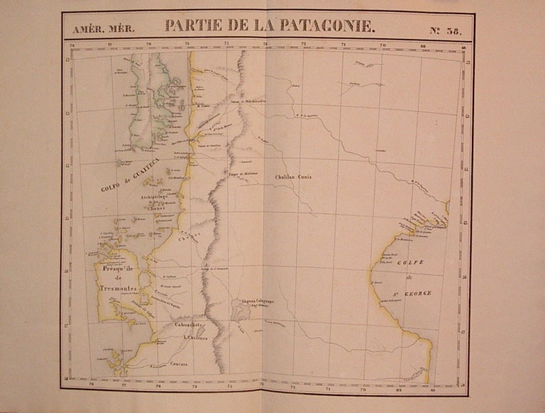
Partie de la Patagonie. Amer. Mer. No. 38.
Brussels: Vandermaelen, Phillipe Marie, 1827.
Map. Lithograph with original hand outline. Image measures 18.75" x 20.5".
Map of southern portion of Argentina and Chile, from the Chonos Archipelago and the Golf of Corcouado in the west to the Golfe of St. George in the east. Double page with centerfold. From Vandermaelen's 6 volume "Atlas universel de geographie physique, politique, statistique et mineralogique, sur l'echelle de 1/16411836". Can be combined as gores to form an immense globe. The atlas was the first to map the world on a uniform scale.
Binding: Unbound
Condition: Very Good
Language: English
Price: $300.00
Item #204795
See all items by Phillippe Marie VANDERMAELEN