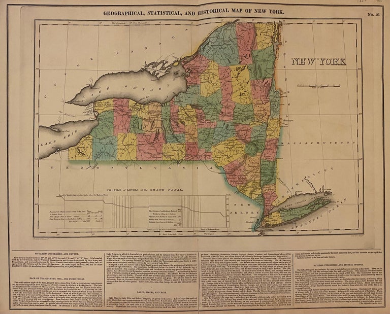
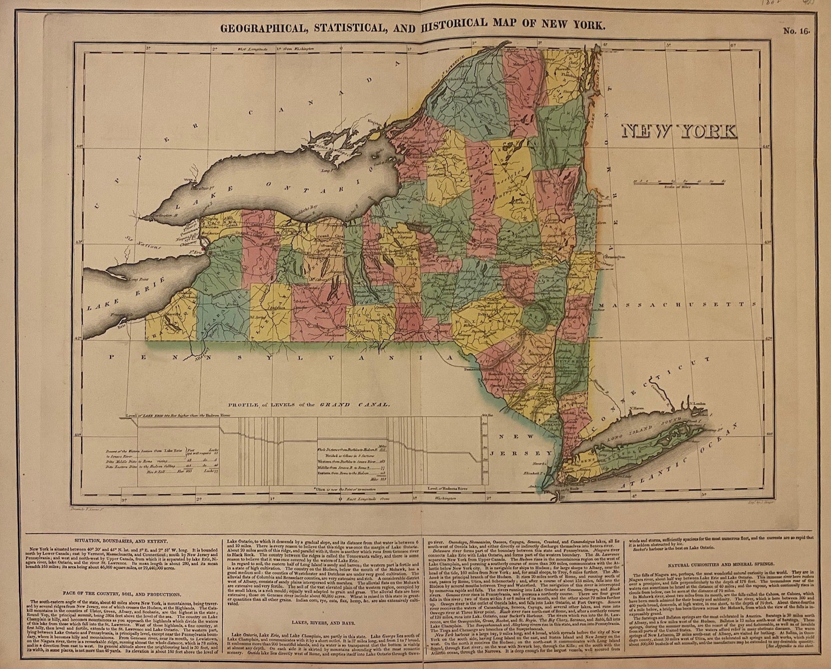
Geographical, Statistical, and Historical Map of New York.
Philadelphia: Carey & Lea, 1823.
Map. Engraving with original hand coloring. Map measures 11.75" x 18.25", map plus text measures 16.5" x 19.5".
Beautiful double page map of New York state divided into counties. Shows towns, waterways, major routes, and geographical features. A table illustrates the profile levels of the Grand Canal. Includes information pertaining to climate and geography. From "A Complete Historical, Chronological, and Geographical American Atlas..." of 1822. Very small tears to edges. In very good condition.
Binding: Unbound
Condition: Very Good(+)
Language: English
Price: $350.00
Item #203344