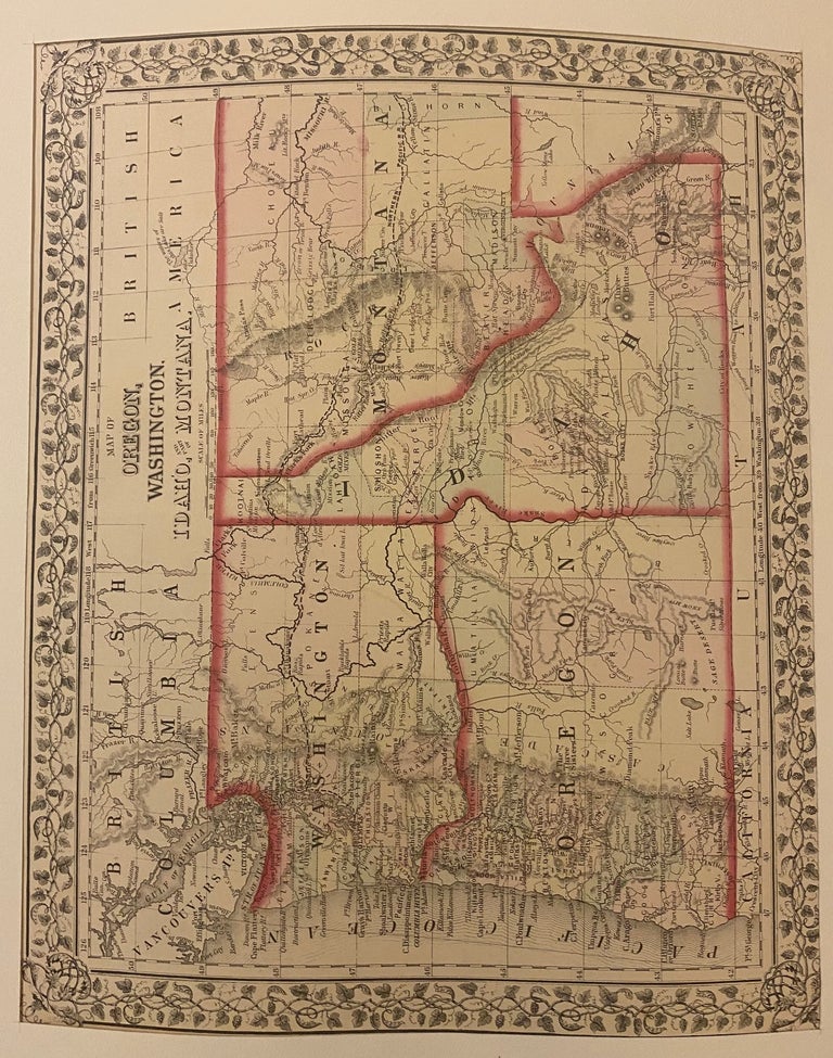
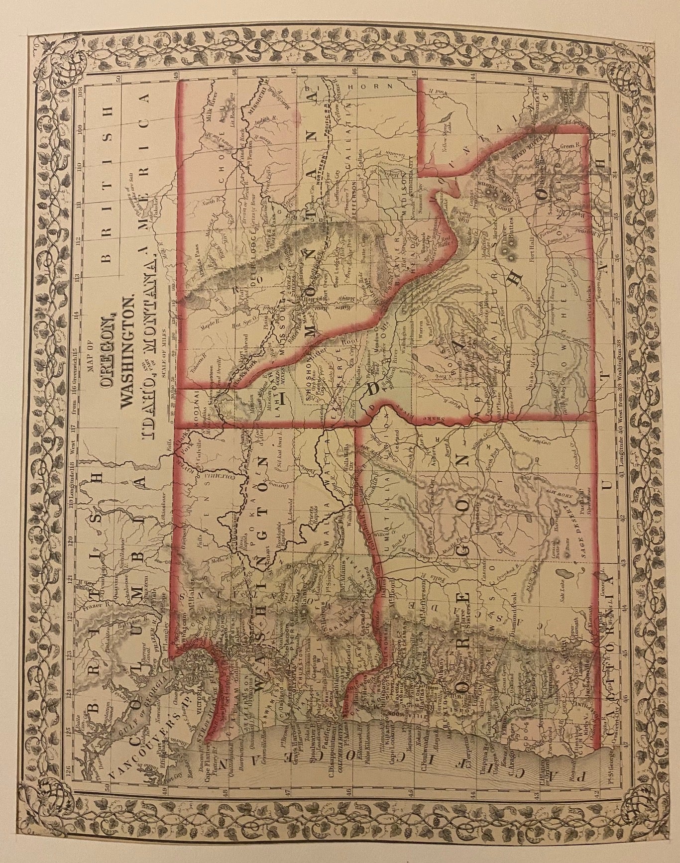
Map of Oregon, Washington, Idaho and part of Montana.
Philadelphia: Mitchell, Samuel Augustus Jr., 1871.
Map. Engraving with original hand coloring. Image measures 10.75" x 13.25".
Classic map of the northwestern states, showing Washington, Oregon, Idaho, and part of Montana. At the time of publication, Oregon was the only territory pictured that had official statehood status, having been admitted into the union in 1859. As the gold rush drew increasing populations, Montana was admitted in 1889, followed by Washington the same year, and Idaho in 1890. The map includes towns, rivers, lakes, mines, forts, missions, and extensive topographical features. Emigrant roads are also shown. This map is in very good condition.
Samuel Augustus Mitchell Sr. (1792-1868) was one of the leaders in American cartography of the 19th century and pioneered the conversion of engraved map plates to more affordable lithographic plates. His son, Samuel Augustus Mitchell Jr. continued his father's successful mapmaking and publishing business, and was one of the most prolific and renowned 19th century American publishers.
Binding: Unbound
Condition: Very Good
Language: English
Price: $175.00
Item #203192