
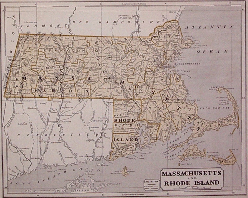
Massachusetts and Rhode Island
New York: Harper & Brothers, 1842.
Map. Color wax engraving (cerograph). Image measures 12" x 14.75".
Great map of Massachusetts and Rhode Island divided into counties and townships showing towns, major routes, waterways and railroads. A fine example of Sidney Edwards Morse's wax engraving technique, from "The Cerographic Atlas of the United States". Minor toning and scattered foxing to margins. A few scattered tears.
Binding: Unbound
Condition: Very Good
Language: English
Price: $150.00
Item #203147
See all items by Sidney Edwards MORSE