
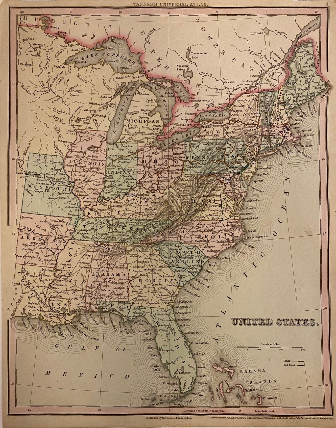
United States.
Philadelphia: Tanner, H.S., 1835.
Map. Engraving with original hand coloring. Image measures 14.75" x 11.5".
Great map of the Eastern portion of the United States, from "Tanner's Universal Atlas." Shows cities, railroads, major routes, topographical details and waterways. Extends from Missouri, Arkansas, and Louisiana to the Atlantic Ocean. Archival tape repair to lower margin.
Henry Schenck Tanner (1786-2858) was an American cartographer and statistical geographer. Born in New York, he moved to Philadelphia where he established his well-known publishing company with his brother. Tanner is widely considered the first native-born American publisher devoted expressly to maps. He is best known and most renowned for his New American Atlas.
Binding: Unbound
Condition: Very Good(+)
Language: English
Price: $265.00
Item #202753