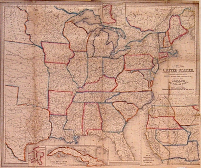
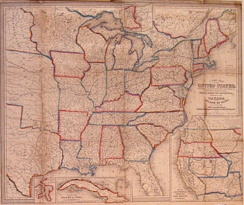
A New Map of the United States. Upon which are delineated its vast works of Internal communication, routes across the continent &c. Showing also Canada and the Island of Cuba.
Philadelphia: Lippincott, Grambo & Co., 1853.
Case map. Engraving with original hand coloring. Image measures 24" x 29.25".
Wellington Williams was a 19th century engraver, publisher, geographer and draughtsman from Philadelphia. Map includes the Gold Region of California, Utah covers Nevada and part of Colorado, the remainder of which is consumed by Nebraska. Washington and Oregon both extend eastward to the Rockies, beyond which is North-West Territory. New Mexico includes present day Arizona. Booklet missing. Map is expertly repaired.
Binding: Unbound
Condition: Very Good
Language: English
Price: $2,300.00
Item #202739
See all items by Wellington WILLIAMS